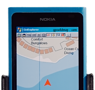
OziCE
Oziexplorer
gps maps

GPS is a satellite navigation system
GPS is funded by and controlled by the U. S. Department of Defense (DOD). While there are many thousands of civil users of GPS world-wide, the system was designed for and is operated by the U. S. military. GPS provides specially coded satellite signals that can be processed in a GPS receiver, enabling the receiver to compute position, velocity and time. Four GPS satellite signals are used to compute positions in three dimensions and the time offset in the receiver clock.
GPS positioning services specified In the federal radionavigation plan
Precise Positioning Service (PPS)
Authorized users with cryptographic equipment and keys and specially equipped receivers use the Precise Positioning System. U. S. and Allied military, certain U. S. Government agencies, and selected civil users specifically approved by the U. S. Government, can use the PPS.
PPS Predictable Accuracy
Standard Positioning Service (SPS)
Civil users worldwide use the SPS without charge or restrictions. Most receivers are capable of receiving and using the SPS signal. The SPS accuracy is intentionally degraded by the DOD by the use of Selective Availability.
SPS Predictable Accuracy
For horizontal accuracy figures 95% is the equivalent of 2drms (two-distance root-mean-squared), or twice the radial error standard deviation. For vertical and time errors 95% is the value of two-standard deviations of vertical error or time error.
Receiver manufacturers may use other accuracy measures. Root-mean-square (RMS) error is the value of one standard deviation (68%) of the error in one, two or three dimensions. Circular Error Probable (CEP) is the value of the radius of a circle, centered at the actual position that contains 50% of the position estimates. Spherical Error Probable (SEP) is the spherical equivalent of CEP, that is the radius of a sphere, centered at the actual position, that contains 50% of the three dimension position estimates. As opposed to 2drms, drms, or RMS figures, CEP and SEP are not affected by large blunder errors making them an overly optimistic accuracy measure
Some receiver specification sheets list horizontal accuracy in RMS or CEP and without Selective Availability, making those receivers appear more accurate than those specified by more responsible vendors using more conservative error measures.
GPS Satellite Signals
The SVs transmit two microwave carrier signals. The L1 frequency (1575.42 MHz) carries the navigation message and the SPS code signals. The L2 frequency (1227.60 MHz) is used to measure the ionospheric delay by PPS equipped receivers.
Three binary codes shift the L1 and/or L2 carrier phase.
Receiver costs vary depending on capabilities. Small civil SPS receivers can be purchased for under $200, some can accept differential corrections. Receivers that can store files for post-procesing with base station files cost more ($2000-5000). Receivers that can act as DGPS reference receivers (computing and providing correction data) and carrier phase tracking receivers (and two are often required) can cost many thousands of dollars ($5,000 to $40,000). Military PPS receivers may cost more or be difficult to obtain.
Other costs include the cost of multiple receivers when needed, post-processing software, and the cost of specially trained personnel.
Project tasks can often be categorized by required accuracies which will determine equipment cost.